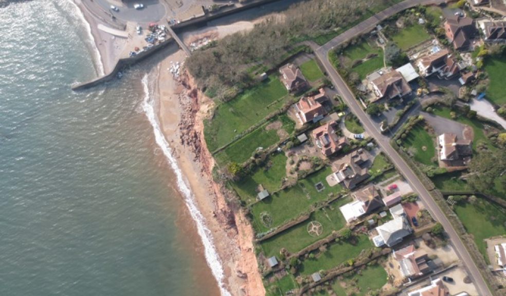
Drone provides bird’s eye seaside view
Sidmouth’s seagulls were joined by a ‘bird of no feather’ when a tiny fixed wing drone took to the skies on behalf of East Devon District Council to photograph Sidmouth beach and cliffs east of the River Sid to provide up to date evidence of coastal erosion for its Beach Management Plan project.
The drone – a SenseFly eBee, weighing just ½ kg and fitted with a compact computer and camera – was carrying out a trial mission commissioned by Plymouth Coastal Observatory. Flying for 45 minute periods at speeds of around 45kmph, the drone - or unmanned aerial system (UAS) as it is officially known - surveyed 3km of the coast over two days, from the headland at Salcombe Regis to Jacob’s Ladder.
On each pre-programmed flight the 1m wide drone captured 250 high resolution images of the beach and cliffs taken at different angles. Controlling the drone from a laptop computer, was Leigh Harris of Kaarbon Tech, a firm from Christchurch, Dorset, which specialises in aerial surveying. The 1500 photographs that were taken will be ‘stitched’ together electronically by Kaarbon Tec to produce a detailed photo-mosaic and contour survey of the coast, which can be used to see and measure changes to the coastline.
Despite its diminutive size and weight, the drone is capable of avoiding aggressive seagulls and is fitted with a wind sensor, which tells it to come home if the weather gets too bad. However, the drone coped with both gulls and gusting winds of up to 25kph over Sidmouth to complete its mission successfully.
Tony Burch, Assistant Project Manager for the BMP, said: “While the primary purpose of the survey is to get a 2015 record of the beach and the cliffs for 300m east of the River Sid, we need to see that in the context of the longer coastline, so the survey covers the whole of the beach from the River Sid to the headland due south of Salcombe Regis. We have also taken the opportunity to include the main beach in the survey so we will have an aerial record of it shortly after last month’s recycling.”
“Existing photogrammetric aerial imagery of the coastline is for 1946, 1950, 1988, 2006, 2009 and 2012. We decided it was important to bring it up to date with this survey and fill in the gaps with other information, so we have the best possible record of how the beach and cliffs have changed over time to base the rest of the project upon. It’s the same with most things: you need to know what the problem is and find out what’s causing it before you can fix it. This up-to-date survey will help us do just that.”
Councillor Andrew Moulding, the council's deputy leader and chairman of the Steering Group said: “We are very grateful to the Plymouth Coastal Observatory for their help. Major aerial surveys of long lengths of the coast using light aircraft are done every five to ten years and are expensive. Using a small drone like this is very cost effective, so ‘hot spots’ like Sidmouth, where erosion is an important issue, can easily be surveyed more frequently. For instance they can be surveyed at the beginning and the end of each winter to see, and more importantly measure the changes. ”


