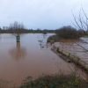
More flood warnings as severe weather returns
The Environment Agency is warning of further floods today issuing 5 flood warnings and 27 flood alerts across the South West as the severe wind and rain continue to affect the region.
The River Teign near Chudleigh and Kingsteignton, the River Yarty and the River Dart are all expected to see localised flooding with residents warned to take immediate flood protection action.
Coastal regions are also asked to remain cautious in th efface of potential flooding, An Environment Agency spokesman said: "From Monday onwards large waves and strong winds are expected along the south and west coasts which may lead to spray and waves over-topping promenades and coastal defences, especially on Thursday as spring tides approach."
The latest warning comes after severe gales and rainfall this morning and last night with very strong winds between 60-70 mph.
The Met Office has said: “The public should be aware of the risk of disruption to travel, particularly as the gales will be combined by heavy rain in some areas.”
The rest weather is expected to Remain very unsettled for the rest of the week, with another spell of wet and windy weather on Tuesday.
Thereafter, staying windy with further bands of rain, interspersed with bright or clear spells and scattered showers.
Many roads are still being affected by the flood after last week’s severe weather although there is very little disruption to most Stagecoach bus services in the county.
So far only the Gold Service is seeing any serius delays due to the A381 in Harbertonford blocked by a fallen tree between the Woodland Road junction and the Cistern Street junction.
Devon highways are attending to the road, which is expected to become clear by this afternoon.
Train Operators are still running their planned timetable and are expected to run their planned New Year's Eve timetables, but depending on the severity of the weather, journeys may be disrupted.
Arriva Trains Wales, Chiltern Railways and ScotRail are all currently being disrupted because of flooding on some routes but there are no local weather issues currently.
The government has pledged to give councils support in cleaning-up following the storms with The Department for Communities and Local Government has writing to local authorities saying that the government had activated the Bellwin scheme.
This scheme enables councils to get financial assistance depending on local circumstances.
It has also asked for assurance that councils are prepared for any future flooding and that everything possible is being done to help those affected by the bad weather during what has been a difficult holiday period for many.
Communities Minister Kris Hopkins said: “Councils have a vital role, along with emergency services in responding to households and businesses which have been disrupted by the floods that have affected parts of the country.
“We want to ensure all possible action is taken to help affected households get the support they need. This includes councils having local emergency plans in place and being ready to provide an immediate response to anyone affected by adverse weather or any other emergencies during the upcoming holiday period.
“We have written to councils to see what practical support they need and the government is continuing to monitor the situation carefully.”
Flood Warnings
River Yarty from Yarcombe to Axminster
Location: Riverside locations and roads between Yarcombe and Axminster, including Long Bridge, Case Bridge, Beckford Bridge and Yarty Bridge
River Teign (Lower) from Chudleigh to Kingsteignton
Location: Riverside properties and roads between Chudleigh and Kingsteignton, including New Bridge, Ventiford, Preston, Teigngrace, Teign Bridge and Exeter Road
River Dart from Buckfastleigh to Totnes, including Staverton
Location: Staverton, and riverside locations and roads between Buckfastleigh and Totnes
A361 East Lyng to Burrowbridge
Location: A361 between East Lyng and Burrowbridge including the Somerset Levels Basket and Craft Centre area
Curry Moor and Hay Moor
Location: West Moor, Hay Moor and Curry Moor including New Road between North Curry and the A361, and Cutts Road at East Lyng
Flood Alerts
River Chew Catchment
Location: River Chew from Chew Stoke to Keynsham, Chew Stoke Stream and Winford Brook
River Lynher
Location: Rame Peninsula, Callington, Saltash, Rilla Mill, Pillaton and Landrake
Mid Devon Rivers
Location: The Rivers Creedy, Creedy Yeo, Little Dart, Lapford Yeo and their tributaries
River Axe Area
Location: The Rivers Axe, Coly, Yarty, Umborne Brook and coastal streams from Branscombe to Axmouth
River Tone Catchment
Location: River Tone from Clatworthy Reservoir to Currymoor, the Hillfarrance Brook, the Halsewater Stream and other tributaries in the River Tone catchment
Middle River Tamar
Location: Polson Bridge, Horsebridge, Gunnislake, Lifton and Sydenham
West Somerset Streams
Location: Horner Water, Rivers Aller and Washford, and the Hawkcombe, Monksilver and Doniford Streams and tributaries
Purbeck rivers and streams
Location: the Corfe Castle and Swanage areas
West Dorset Rivers and Streams
Location: the Rivers Lim, Char, Winniford, Simene, Brit, Asker, Mangerton and Bride
Weymouth Rivers and Streams
Location: the River Wey to Radipole Lake, Preston Brook and River Jordan
South Somerset Rivers, Upper Reaches
Location: Rivers Parrett and Isle and tributaries
Upper River Tamar
Location: Bude, Helebridge, Bridgerule, Canworthy Water and Yeolmbridge
North Dartmoor Rivers
Location: The Upper River Taw from Sticklepath to Newnham Bridge and the River Okement and its tributaries
Rivers Clyst and Culm and their tributaries
Location: Hemyock, Cullompton, Stoke Canon, Broadclyst and Clyst St Mary areas
Rivers Otter and Sid, and Exmouth Area
Location: Lympstone, Exmouth, Budleigh Salterton, Honiton, Ottery St Mary and Sidmouth areas
River Dart Area
Location: Totnes, Ashburton, Buckfastleigh, Dartmouth and Torbay areas
South Devon Rivers
Location: the Rivers Avon, Erme and Harbourne, coastal streams from Bigbury to Dartmouth, and Kingsbridge, South Brent and Ivybridge areas
River Teign Area
Location: The Rivers Teign, Bovey and Lemon and coastal streams from Babbacombe to Kenton


